


SIA Center of Excellence: 3D Visualization and Digital Twins
Visual Plan CEO and a member of SIA’s Public Safety...

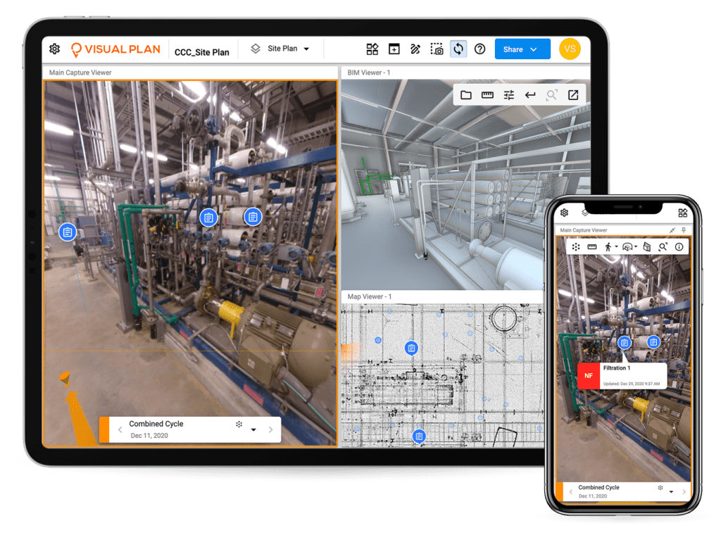
Visual Plan Completes Phase 1 of Significant Digital Twins Integration Contract for Felipe Ángeles International Airport
Visual Plan announces the completion of Phase I of a...

Kelly Watt joins Geoffrey Cann for latest episode of Digital Innovations in Oil and Gas
Visual Plan CEO and founder Kelly Watt joins the latest...

