Our team in Latin America recently worked on a church project in Santiago Chile. The project was photographed by Sebastian Graterol this Monday, September 2, 2019, completed in an afternoon and processed the next day.
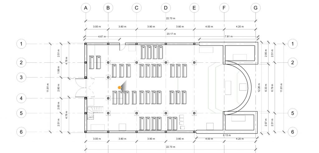
The 2D Plan was initially created using the beta Sketch tool in Visual Plan and then brought into Revit where the 3D BIM Model was created by taking reference measurements on the images. We also scanned the project with a FARO laser scanner as there was a separate application for monitoring the structure, but all diagramming and modeling was deliberately done without point clouds as we wanted to compare accuracy and workflow relying only on the photogrammetric model created from the 360° image capture.
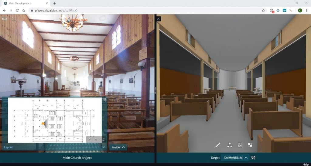
No question the image capture was far faster, although with such a small building we did not feel the time as significant. Through a comparison in measurement accuracy to the 3D laser scans, we were very happy to see <1cm difference from the point cloud. Although certain building applications will require higher accuracy, this was well within the tolerances needed for our application which includes a design element.
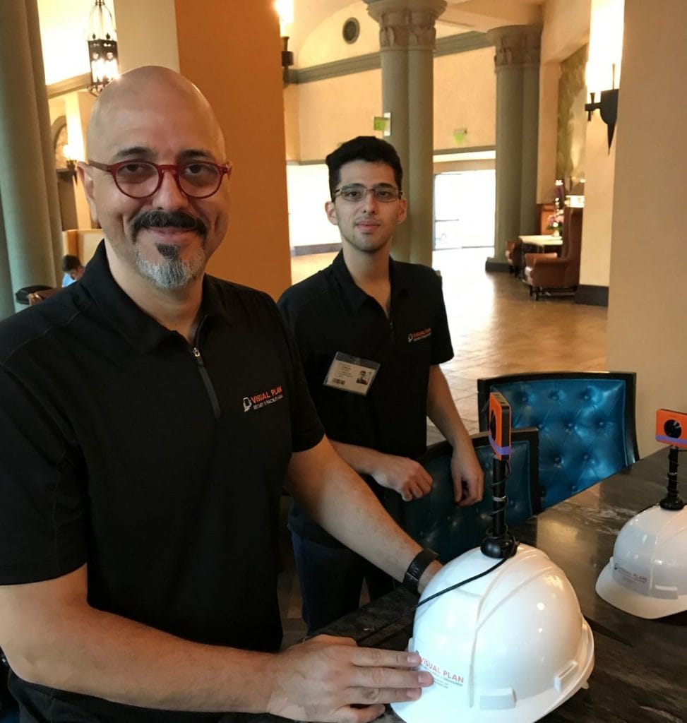
Great job and a shout out to our office in Santiago Chile. Photo left is Luis Graterol, Principal and General Manager of Visual Plan LATAM. Photo Right is Sebastian, Principal, and Director of Operations Visual Plan LATAM.
Sincerely,
Kelly Watt | CEO & Founder of Visual Plan Inc.
Office 1(206) 202-4220 | kelly@visualplan.net| www.visualplan.net
Collaborate, Share, and Plan with Rapid 360° Capture