If you need to build a 3D design model from an existing condition or develop a BIM for construction or asset information management, 3D Laser Scanning is an excellent process to ensure accuracy, and reduce waste, time, and costly mistakes. Accurately monitor clashes, movement, flatness, plumbness, thickness, deviations, and artifacts to the millimeter level. Deploying 3D Laser Scanning provides the ground truth to make the big and costly decisions with high confidence as you have gamed out the potential failures virtually before the physical implementation.
3D SLAM And UAS Lidar For Large & Fast.
Mobile Lidar (SLAM) expedites the scanning process 10X while still collecting accurate point cloud data. The process is economical for large-scale 3d scanning and ideal for open areas and long stretches where accuracy is important but terrestrial lidar is overkill.
LiDAR from a UAS drone platform provides highly accurate and granular data that surpasses what has been traditionally collected from fixed or rotor-winged aircraft. UAS can also carry thermal and optical gas cameras, high-resolution zoom cameras for inspections, and provide a variety of valuable deliverables.
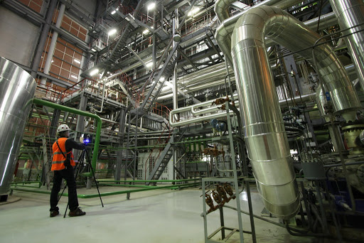
3D Terrestrial Lidar
High Accuracy, survey control, 3D modelling, monitoring, detection, and analysis.
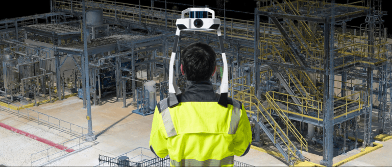
3d mobile lidar - SLAM
Rapidly capture large areas quickly with SLAM to create 3d point clouds of open space.
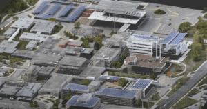
3d aerial lidar
Drone mounted SLAM provide fast, accurate capture of large and hard to reach areas.
3D Terrestiral LiDAR, SLAM, or aerial Lidar?
When it needs to be right, terrestiral lidar, SLAM and aerial lidar scanning provide accuarate the 3d data required to got the job done.